Home / Services / Digital Land & Survey

Digital Land & Survey

Precision digital land surveying and geospatial solutions for accurate, data-driven land management and development planning.

SERVICE OVERVIEW

Delivering Precision Land Data Through Advanced Digital Survey Techniques

SARM Associates Limited provides comprehensive digital land surveying and geospatial consultancy services for public and private sector clients. We utilize state-of-the-art technologies including GPS, GIS, drone photogrammetry, and total station surveys to deliver accurate spatial data for land acquisition, boundary demarcation, topographic mapping, and development feasibility studies.

Our multidisciplinary team of licensed surveyors and GIS specialists integrates digital survey data seamlessly into engineering design, urban planning, and infrastructure projects, ensuring reliable and legally compliant land information that supports informed decision-making.

Services

Our Digital Land & Survey Services

Comprehensive digital surveying services from data acquisition to geospatial analysis

GPS & GNSS Surveying

High-precision GPS and GNSS-based land surveys for boundary demarcation, control networks, and topographic mapping.

GIS Mapping & Analysis

Geographic Information System mapping and spatial data analysis for land use planning, asset management, and decision support.

Drone & UAV Photogrammetry

Aerial drone surveys and photogrammetric processing to generate high-resolution orthomosaics, DEMs, and 3D point clouds.

Topographic Survey

Detailed topographic surveys capturing natural and man-made surface features for engineering design and planning purposes.

Land Boundary Demarcation

Legal boundary surveys, land subdivision, and demarcation services compliant with national land registration requirements.

Cadastral & Land Records

Cadastral survey, parcel mapping, and digital land records management for government agencies and private developers.

Types of Survey Projects We Deliver

Land Acquisition Surveys

Precise boundary and area surveys for infrastructure project land acquisition and compensation assessment.

Urban & Regional Mapping

Comprehensive GIS-based urban mapping and spatial analysis for city planning and regional development programmes.

Infrastructure Route Surveys

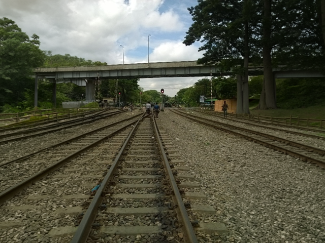
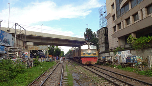
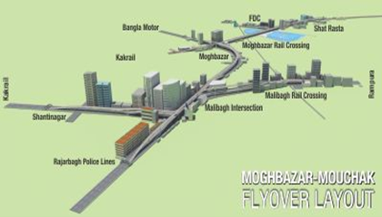
Route survey and corridor mapping for roads, pipelines, power lines, and other linear infrastructure projects.

Digital Terrain Modelling

Creation of high-resolution digital elevation models and terrain datasets for flood risk, drainage, and site analysis.

Process

Our Project Approach

A structured process to deliver reliable and accurate digital survey solutions.

01

Scope & Mobilisation

Project briefing, site reconnaissance, control network setup, and survey instrument mobilisation.

02

Field Data Acquisition

Ground-based and aerial data collection using GPS, total stations, drones, and LiDAR as applicable.

03

Data Processing

Post-processing of raw survey data, GIS integration, quality control, and accuracy verification.

04

Deliverables & Reporting

Production of survey maps, digital datasets, GIS layers, and technical survey reports for client use.

Portfolio

Featured Digital Land & Survey Projects

Selected digital land survey and geospatial consultancy projects by SARM.

Detailed design and full-time supervision of Bahaddarhat Junction Flyover, Chittagong, funded by GOB.
Design and supervision of 669m 4-Lane PC Girder railway overpass connecting Bijoy Sarani to Tejgaon Industrial Area, Dhaka, funded by GOB.
Design review and supervision of Mohakhali Flyover (1.01 km) and feasibility study of Jatrabari Flyover (1.81 km), Dhaka, funded by World Bank.
Prefeasibility, feasibility, design and supervision of 5.2 km Muradpur Flyover and 2 gate junctions, Chittagong, funded by GOB.
Construction supervision of 645m PC Girder Kadamtoli Junction Flyover (Railway Overpass), Chittagong, funded by GOB.
Construction supervision of 8 km Moghbazar–Mouchak Combined Flyover, Dhaka, funded by Kuwait Fund (KFAED).
Our Client

Our Key Clients in Digital Land & Survey

Ready to Start Your Survey Project?

Contact SARM for professional digital land surveying, GIS, and geospatial consultancy services.

Related Services

Transportation

Transportation planning, traffic analysis, and road infrastructure consultancy

Project Management

Construction supervision, contract management, and quality services

Environmental Services

EIA, social assessments, and environmental monitoring